Construct of an Empirical City

Cornell University Architecture, Art and Planning
Faculty: Prof. Pedro Erber
Degree: M.S. AAD
Semester: Spring 2019
Duration: 1 Semester
Site : City from Memory
Type : Architecture Research, Urban design, City planning,
Phenomenology.
Faculty: Prof. Pedro Erber
Degree: M.S. AAD
Semester: Spring 2019
Duration: 1 Semester
Site : City from Memory
Type : Architecture Research, Urban design, City planning,
Phenomenology.
Prelude:
“When I think of architecture, images come to my mind, images of worlds different from ours. I believe our world is a collection of overlapping microcosms of different scales, we enter and exit these microcosms daily, but few of them are so small or large in scale that it becomes inconceivable to us. Like the space between the complex matrix of a sponge or a trabecular structure of a bone; between the growth of branches in a tree or spaces in between the riverine system of a river; in the complex neural network of our brain or the networks of streets in our cities. Everything has a world of its own, we have our own world built through interactions of forces from the outside world.”
Introduction:
Cities are the greatest inventions of human civilization because it is not a static object in space, but a living organism in time, always in the state of flux; ever-changing and eternal. When I think about the city, I wonder, what will be my city, how do you define my city, how do one associate oneself with one city, cities predates me and will certainly postdate me, they are large and ever-growing, It will be impossible for me to know the city completely throughout, and it is even more difficult to associate with one city when we live in a globalized world where we perceive the world as one global village at the same time we are divided by borders, states, continents, race, language, ethnicity, economy, religion, and political affiliations. It’s even more difficult to associate when we know that the notion of affiliation lays the foundation to divide oneself from the rest.
Being born in the internet age, I am more familiar with New York City, from its Central Park to Brooklyn Bridge, from Broadway to Times Square, from Flatiron to Empire State buildings, the city I have never been before, then the city I have lived most of my life, this brings us to the most important point in the 21st century where the media and technology becomes the dictators of the culture in a society. In the era were Instagram dictates the flow of tourist, google maps changing the traffic movement in our cities to online reviews turning a restaurant into a tourist attraction.
Reading Italo Calvino’s Invisible cities inspired me a lot during my undergraduate studies – which led me to believe that traveling changes your notion of this world and what you take for granted in one society would put you at risk of execution in another. It broadens your perception of the world, and it liberates you and allows you to perceive a society without prejudice and preconception. With this intention in mind, I developed my interest of walking across global cities like Cairo, Jerusalem, Amman, Hong Kong, Bangkok, Kuala Lumpur, Mumbai, Bangalore, Delhi, Ahmadabad, Tokyo, Osaka, Yokohama, Sydney, Colombo, Dubai, and New York. One can only perceive these cities in slow-motion and observing the changes in its skyline, streetscape, activity, culture, food and even smell varies from one end of the city to another end. One of the most evident is Tokyo and Yokohama two cities close to each other and physically inseparable, but as you walk across them. You can feel that both are completely different cities even the smell of the city is completely different; makes you question the very geographic proximity to the two cities.
From my travel experience and opportunity to live in many cities, I started to believe that it is impossible to associate oneself with a city or call one city like my city as we are associated with only a fragment of a city, like the neighborhood of our residence or work, the streets that we commune frequently, the neighborhood of friends and family, the shopping districts or the cultural or recreational districts, the whole notion of a city is a construct of these fragments of the city that we are associated with not the city in entirety. If we have lived in various cities, then the city would be a construct of various fragments of various cities.
If we closely observe the conversation between Kublai Khan and Marco Polo in Italo Calvino’s Invisible cities, we could imagine those cities to be the cities Marco Polo visited during his expeditions or each city could be a fragment of a big city. This uncertainty around the validity of facts that these cities exist, leads us to question the very existence of these cities and this uncertainty with the narration that describes the city with characters far from reality, allows us to imagine these cities and construct it in our own imagination, which makes us fantasize about them, making them mystical. We could obnoxiously argue the very basis on which these cities are built on, could also be a narration of a trip Marco Polo took to Disney Land with his kids last summer and when Kublai Khan demanded to entertain after being drunk, Marco polo had no choice but to construct a story from his visit to Disney Land. Let us not take this stance but assume that these cities exist either in fiction or reality in Marco Polo’s life, in that case, how can we interpret our own cities in this format? how do you construct a city from your own experience? Going back to our previous question, how do you take ownership of one city if you have lived in multiple cities? This paper looks into answering these questions by constructing an Empirical City, built on the experience and life one lived in these cities. Stitched from fragments of experience and knowledge one gained throughout their time living or traveling through those cities.
Construct of an Empirical City:
I was born to an Empirical city that has a history dating back to millennia, this city had a small district within it which dates back to the 14th century. This district was a seat of capital for many kings through history and center for trade and commerce. It was in 1888 the municipality for the district was established and in 1897 half the districts’ population was killed in a Bubonic plague and in 1903 district improvement trust board was established to undertake planned development.
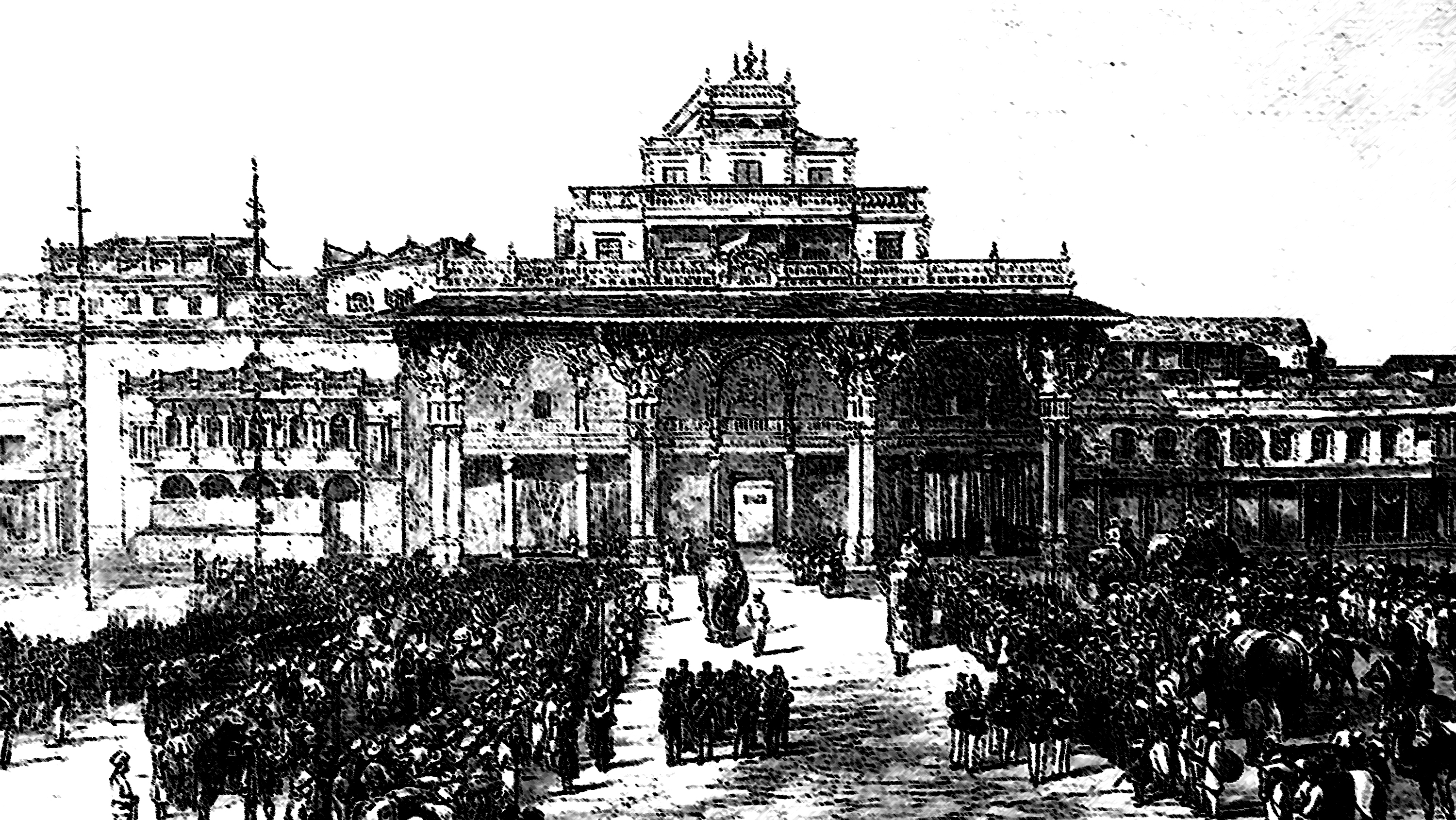
The then Maharaja (King) had laid out the region in the image of Paris, the Paris after the renovation by Georges-Eugene Haussmann as described by the paper - “Paris: Capital of the Nineteenth Century” by Walter Benjamin. Every day my commute to my school and university was along the tree line boulevards faced with a historic building constructed in Indo – Saracenic Style (Style embraced by the British East India company as a hybrid between Hindu and Islamic architecture), The pedestrian paths were so wide that it was planned to have an entire three generation ( Grandparents, Parents, and children) to walk holding hands together. Many of the streets were radial, forming circles at various intersections.
The city has a large palace centrally located with a large plaza in front of it with many temples at various corners and a Large fort encompassing the palace, temples and the plaza. The palace was built in 1912 after the fire destroyed the old wooden palace built with Sandalwood during the wedding ceremony of the princess. I always wondered why was there a necessity to construct the plaza and so many temples inside the fort and not be used most of the time, as per the book published by Benjamin Lewis Rice – Mysore and Coorg in 1876, we found that before 1897 the entire city was within the fort and due to the fire in 1897 and subsequent to rebuilding of the new palace in 1912 the entire city was moved outside the fort, but the temples remained in place. It is also known from the palace history published in its official website that the current palace is the 4th one in place as the first one was destroyed by lightning and second was demolished after losing the war.

The city moved out to the region outside the fort around the market, I remember that my childhood was around these streets as I used to live there, and street provided security and protection as everyone knew everyone else, and the street acted as a social condenser, we used to play on the streets, lined with Mangalore tiled houses with 1 feet thick walls built with brick and lime mortar kept the house cool during summers. our friends and family were all the residents of the streets, we would have lunch at someone else house and the most memorable was that the old grandma would cook noodles for all the kids in the street. As we grew older these streets become more and more commercialized which pushed us further and further away from the city center, which is more in line with the suburban regions of today’s cities.
As I grow up the city expanded and the old streets slowly turned in to commercial centers and residents moved to suburbs to seek quitter life, day by day the old charming houses were demolished to make way for concrete commercial buildings. We moved to a suburb that was still under development, vacant plots and streets become our playgrounds and people became stranger and individualistic. If we move further from here to the north, there are places in the city that are more reminiscences of economic enclave as described by Keller Easterling in her book Extrastatecraft: the power of infrastructure space, large swath of land completely cut-off from the city main grid, general public are inadmissible unless you are live their or work there. Places where rules, regulations and state policies are exploited to the advantages of global corporates for profit at the expense of the environment, health and social welfare of working class by overly relying on cheap labor from underdeveloped states.
After
I graduated from university, I no longer could sustain in this part of the town
and had to move to either the economic enclave or to other part of the city
like every other college graduate as there were
no lucrative jobs as the administrators are more concerned about making this part
of the city as a pensioner’s paradise than the place for young workforce. I
moved from this part of my town to part facing the sea to its west, I faced the
most extreme form of the city, the most bizarre and chaotic part where the
suburban railway lines carry 7.2 million people daily along the north-south axis. This part of town could also
be an image of dystopia, the image of disharmony, the tall super luxurious
towers hovering over the poor slums, every day, everyone toils to work, the
struggle to survive in this wild was overpowering,
I saw people fall from this overcrowded trains and die and this was so common
that people had grown impervious to such incidents. It was a common sight to see an entire family living on
sidewalks, or under overpass living their daily life of cooking, sleeping, and
playing with their kids and it's common
to hear the entire family sleeping on these sidewalks getting killed by a drunk
driver driving over them in the night.
The city of dreams some call it as, the business center, where many young graduates come to seek work and earn money and dream to make it big, the beauty of this part of the city is not in its high rises but in the slums. One-night when I ventured into one of the slums, I realized how dense and at the same time how strong the community works. As I walked through one of the slums, the street becomes narrower and narrower. The boundary between the interior of the house and the street was almost invisible, this made me feel conscious, am I in someone else’s house? Or am I still on the street? The street became so narrow that only one person could move at a time. As I move forward the street ended and opened itself to a large courtyard, it was the most interesting part of the slum. The houses looked like shipping containers made of corrugated a luminum panels, stacked one above the other, the terrace of one house becomes the front yard of the house above it. The women had gathered together to work, they were employed by the local company to make paper bags and the kids were playing in the courtyard so the women could keep an eye on them.
The city of dreams some call it as, the business center, where many young graduates come to seek work and earn money and dream to make it big, the beauty of this part of the city is not in its high rises but in the slums. One-night when I ventured into one of the slums, I realized how dense and at the same time how strong the community works. As I walked through one of the slums, the street becomes narrower and narrower. The boundary between the interior of the house and the street was almost invisible, this made me feel conscious, am I in someone else’s house? Or am I still on the street? The street became so narrow that only one person could move at a time. As I move forward the street ended and opened itself to a large courtyard, it was the most interesting part of the slum. The houses looked like shipping containers made of corrugated a luminum panels, stacked one above the other, the terrace of one house becomes the front yard of the house above it. The women had gathered together to work, they were employed by the local company to make paper bags and the kids were playing in the courtyard so the women could keep an eye on them.

I could no longer live this life of struggle and toil every day, hence I moved another part of the city which is still facing the sea to its northwest. The part of the city is a land of luxury the land of liquid gold, the region that was just a fishing village 30 years ago now a simmering metropolis, with towers reaching beyond the clouds, new towers being constructed to reach further than the precedents. This part of town had a strange obsession for luxury, everywhere there was this obsession for gold, and exotic. They wanted to build on water and reach out to sea, they were building expensive luxury villas on the artificially created island created in the shape of a Palm tree or the map of the world where you could buy a country or a continent. The strange obsession with iconography and everything looked fake, the building and their streets and bazaars were all built to replicate the old. There was a strong desire to build a new building in the image of the old than to revive the old to bring the natural character of the city.
The city built on the foundation of economic enclave; it was the free trade zone with a shipping port built in 1985 resulted in the rapid expansion of the region. Made the region one of the prime trade routes between the east and western hemisphere of the earth, the city center was gentrified resulted in building skyscrapers over the ruins the traditional homes built with Barasti – Palm Fronds. Just like the previous part of the city, this region too witnessed a smallpox epidemic in the 1841 and in 1896 fire broke out destroying half the houses in the region.
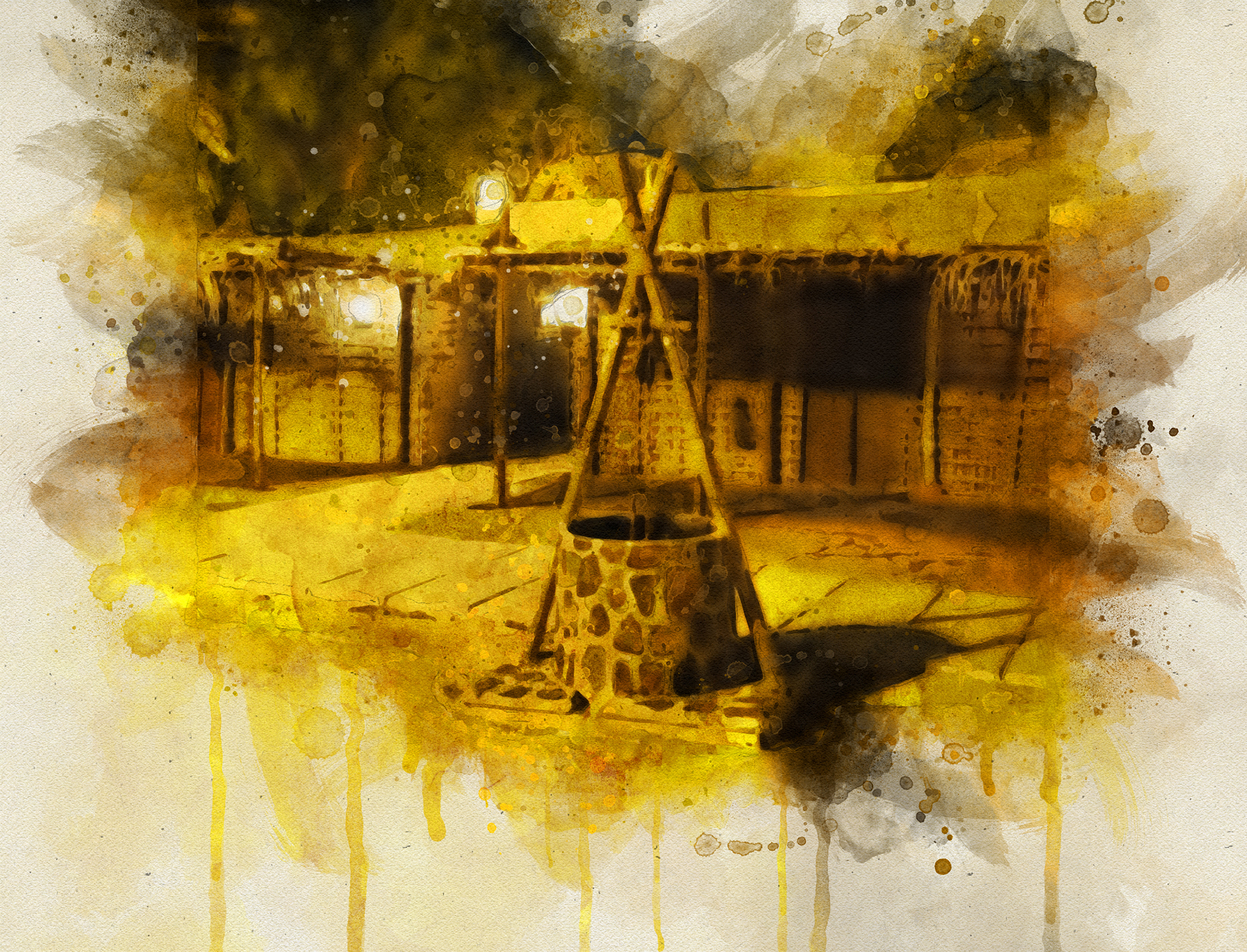
My journey through this part of the town took me to various nooks and corners of it, but the most interesting part was the creek area in the old town, the region was lined with bazaars and market along the river with boats ferrying people across. People spend time on the edge of the river at restaurants and café, covered with canopies only lit by lamps on the pedestal. The building along the river are built with traditional methods of clay blocks and Palm fronds as a roofing material. Above each building, we could find the rising towers with large opening built which draws the wind into the buildings below and the small pond of water below the tower cools the air and allows it to circulate throughout the building. These towers built over traditional buildings gives them a resemblance of San Gimignano in Italy or the image of Diomira from Invisible cities.
From there I moved east to another part of the city facing the sea to the south, the region that stood the test of time, build to show the strength and the courage to rebuild on the ashes of world war II, to region that was built on the manifesto of Metabolism movement in the 1960s, another megapolis with the most efficient public transport system the part town with 35 million people but still didn’t find any traffic blocks. Just like the previous part of town they had also built an artificial island on the sea but with a very democratic agenda of providing additional space for the center of the city than to the desires of the rich. The city built in the spirit of growth and prosperity, to reach beyond the land and the sea. the neighborhood I lived was quite dense, each building with a small footprint enough to park a car sometime.


This part of the city is known for its neon light that glitter the shopping streets, signage, and billboards sour the facades of the building, creating chaos filled with neon lights for the pedestrians. The most interesting aspect of the region is the earthquakes, anywhere in the world earthquake seems like a disaster but here it’s part of the daily life. My first ever experience of the earthquake was here, early in the morning I felt like I was in a dream that I am sleeping in a cradle and somebody is swinging the cradle. But the shock was so strong, I realized its not a dream its reality that my bed is shaking. I woke up to find my self in the middle of an earthquake. I ran out to streets to save my self, only to find that the rest of the people are not bothered by it, going to the office and school as usual. This made me realize that the people have developed resilience towards such natural calamities, they have experienced it so much that it no longer affects them. As I lived longer, I see that the buildings are mostly earthquake proof and the infrastructure, and the cities are built to withstand any natural disaster. The city is fortified not against enemy or an army but against the nature’s forces, the rivers are embanked on both sides to protect the city from flooding or Tsunami and the canals are built with flood gates and a large underground tank built to store water from overflowing rivers, the columns of these tanks are so large they resemble building towers making them look like an underground city.
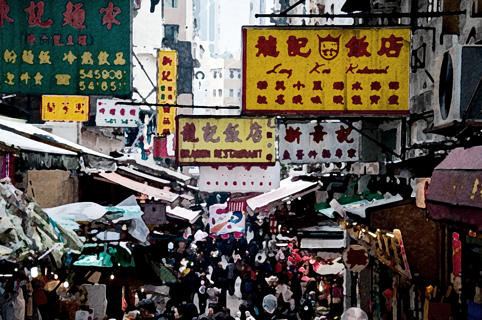
I moved west to another part of the city, highly dense with lots of skyscrapers over the hill facing the sea. the hill is completely covered with skyscrapers and the narrow streets between the skyscrapers running up the hills are turned in to the street market, where vendors sell souvenirs or food on their pushcarts. The trams run in the center of the streets and tall buildings completely cover the streets with their shadows. This region is completely devoid of open spaces, the streets meet the buildings edge and the narrow sidewalks are filled with people, the only place we can stop and have rest are the shopping malls and seafront. The towers are very narrow in the base but rise above the ground so high that it feels delicate and break anytime, the visuals develop tension in the mind of spectators.


I moved further west to a historical part of the city, one of the oldest parts where the three religions confluence to form the most controversial place on earth. The center part of this region is a fort with a central bazaar, and religious structures spread across the fort area. It's more than two-thousand-year-old fort with structures belonging to all the three Abrahamic religion. the fort and most of the structure is built with stone and historical market streets resemble the medieval European streets with arcades and canopies covering the street. The streets run like a maze shifting levels at various turns and stairs taking you to different levels, completely organic in nature. Easy to find lost tourist within the fort, but also the most condescending moment is the security forces guarding every entry point and at various junctions of the fort area.
Then I moved further west to another part of the city,
to the most developed and well known throughout the world as the world
financial capital. It is very fresh in my memory as I currently live in this
part, hence I take the liberty to explain this part of the town much longer. I
lived on an island, in this region, the very interesting area within this
region as the island was visually connected to the metropolis but physically
disconnected also the atmosphere was very different from the mainland. Island is a 2.5-mile-long land in the middle of the river between the land of
skyscrapers and residential suburb with an area of 147 acres. Historically
during the early 19th century, the island was then used for public
facilities like a penitentiary, smallpox
hospital, cemetery, and a mental asylum.
In the mid-twentieth century, the city drastically transformed the island following the construction of Bridge over the island without providing access to it in 1909. The island was renamed in 1921 after the public hospital built in the southern end. Automobile and trolley transportation was possible to the island after the construction of a vehicular elevator from the bridge in 1930. Two large hospitals opened in the next three decade and in 1955 the island bridge was constructed, connecting the island with the suburbs and allowing more vehicular traffic.
Today the island is home for an Ivy League institution and series of housing developed by Philips Johnson and John Burgee and others. We can understand that the island is more or less in aligning with the idea proposed by Lewis Mumford about city being a stage for social drama which is also evident in the statement put forward by Philips Johnson and John Burgee in their proposal – “Main Street, the spine of the Island Town, is where the action is. Here are shops, kiosks, mini-transit stops-and 12-story apartment buildings angled to lend curiosity to the streetscape”


The housing buildings by Johnson and Burgee stepped
down to the rivers on each side, a decent housing, not a grand monument, and the only exotic feature was
the series of riverside steps what Johnson called the Ghats of Banaras in
India. The island community was planned in the image of Jane Jacobs idea of the
organic city, but the proposal didn’t
live up to the idea of the organic city
as the street’s layout was designed in a top-down
approach than the bottom up. The empirical observation also reviled that the
opportunity to connect from the main street to the rivers has been unutilized
as the ground level is built completely
covering the river view.
The idea of Empirical City is perpetual, and it continues as long as I live, it will expand as I visit new places. It is subjective to the individual, the city that I take authorship is not the city you will have. But might have fragments like your if we have lived in the same city and had a similar experience but it will not be the same in entirety. If we consider each one of us having a city of their own built from their experiences and life, then we are looking at seven billion different cities. Each city completely owned by the individuals who have experienced it in their lifetime.
Conclusion
The idea of Empirical City is perpetual, and it continues as long as I live, it will expand as I visit new places. It is subjective to the individual, the city that I take authorship is not the city you will have. But might have fragments like your if we have lived in the same city and had a similar experience but it will not be the same in entirety. If we consider each one of us having a city of their own built from their experiences and life, then we are looking at seven billion different cities. Each city completely owned by the individuals who have experienced it in their lifetime.
Bibliography
· The island nobody knows by Philips Johnson and John Burgee, Published by New York State Urban Development Corporation
· Manhattan’s other island, by Anthony Bailey published in the New York Times on Dec 1974 - https://www.nytimes.com/1974/12/01/archives/manhattans-other-island-roosevelt-island-a-case-study-in-how-to.html
· Roosevelt Island: Exception to a city in crisis by Yonah Freemark https://yonahfreemark.com/wp-content/uploads/2017/07/Freemark-2011-Roosevelt-Island-Except-to-a-City-in-Crisis.pdf
· Roosevelt Island, by New York City Urbanism - https://www.nycurbanism.com/brutalnyc/2017/2/15/eastwood
· Italo Calvino, Invisible Cities
· Walter Benjamin, -“Paris – Capital of the Nineteenth Century”
· Hackworth, Jason - The Neoliberal City: Governance, Ideology, and Development in American Urbanism
· Lewis Rice, Benjamin – Mysore, and Coorg a Gazetteer
· Easterling, Keller - Extrastatecraft: the power of infrastructure space
· Christopher M. Davidson - Dubai: The Vulnerability of Success
